Description
|
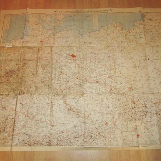
Made of heavy paper, this Navigational Map is in SUPERB condition for its age! Recently found in a Belgium, single-sided, it measures approx. 27″ x 38″ in size, and shows various locations of lakes, seas, towns, villages, cities, and elevations. Also features longitude & latitude degree markings. Some slight marks and wear due to the age, but nothing that detracts. Being a 1:40000 scale, it is HIGHLY detailed, right down to individual houses! The color section of the map is Belgium, while the black and white section is the Netherlands. Produced in 1941 by the General Stab. der Heer, it is one of the largest and most detailed maps I have seen! Used until the end of the war, it would make a FANTASTIC addition to any collection, display, or simply as a conversation piece! |