Description
You are bidding on a SUPERB WW2 German Wehrmacht 1940’s “Battle of France” Period Map and Aerial photo set! This set specifically covers North East France, Paris and surrounding areas, and ranges in scale from 1:10000 to 1:750000!
Produced June of 1940 by the Generalstab des Heeres, this set would have been used by both the Luftwaffe and Wehrmacht units. These sets were originally made prior to the start of the Battle of France (May 1940), and would have been planned for use during preparation for the Operation, as well as during the occupation.
Made of heavy paper, this map and aerial map set is in EXCELLENT condition for its age. The main folder does have a few marks and signs of wear, but it is still quite solid. All information is clearly legible. This set consists of 1 book depicting aerial and topographical images of various landmarks and points of interest; as well as 8 additional full color maps!
The book is dated 1June 1940 and is approx. 174 pages. It is a concise overview of France, describing populations and landmarks of various towns and cities in alphabetical order.
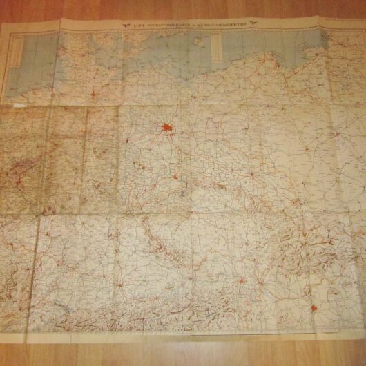
The remaining items are a collection of 8 maps, and each vary in scale. They cover all of North Eastern France. A VERY detailed map set, they are printed in full color. All are in SUPERB condition, and generally measure approx. 30″ x 36″ in size.
A VERY RARE and FANTASTIC addition to any collection, display, or simply as a conversation piece!